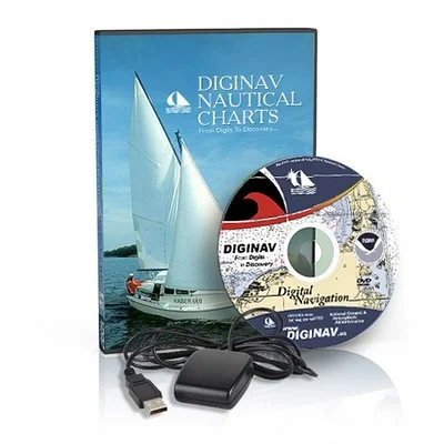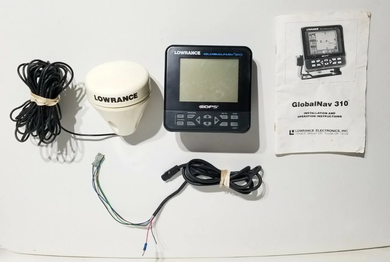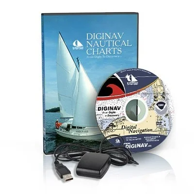
NOAA Nautical Charts GPS Marine Navigation Software DVD !!COMPLETE SYSTEM!!
USD $69.99
- Condition:
- New
- Shipping:
- Free Shipping
- SKU:
- N/A
- Categories:
- eBay Motors / Parts & Accessories / Boat Parts / Electronics & Navigation / GPS & Chartplotters


Price alert
Notify me when the price drops
Description
Certified noaa rnc chart distributor "diginav gave superior support to configure gps to work with software" -sailinggary "great program and features - best value of the ebay listed dvd chart programs" -keith_seeker welcome thank you for visiting diginav nautical charts. we are an official noaa certified chart distributor . diginav created the nautical charts dvd and plotting system as a valuable and inexpensive way for sailors to get the complete updated collection of noaa charts. these charts are just like paper charts but on a computer. the dvd also includes features such as the dvd menu, video tutorials, noaa chart #1, bowditch (practical navigator), 33 nautical calculators, light list, coast pilot, pdf chart table, dvd case and label. our disc contains over four gigabytes of nautical chart files and images equaling approximately 2200 charts. this dvd includes all of the noaa rnc (raster) charts. this is the easiest way to get into chart plotting. all you have to do is insert the dvd, click a button and you have all the charts right at hand. you can our gps to track your positions, setup waypoints, print out charts and much more. our dvd is compatible with; win 10, win8, win 8.1, win7, vista, xp, win2000, nt, me, win98, win95. this is a true, "plug and play system" and can be run directly from the dvd meaning no installation required although you have the option to install to a hard drive! our dvd's are shipped out the same day so you can have it in as little as two days depending on location! the tutorials are very informal but in the rare event should you need any technical support we are here to help. you will not be left on your own. click on the image to view actual size menu! dvd menu here is a look at diginav's unique dvd menu . this is the screen you will get after you have inserted the dvd. from here you can easily install programs or view any of the publications on the dvd. seaclear ii is included on the dvd along with adobe reader 8 . we recommend first starting with the video tutorials. this way you can get a little familiar with seaclear ii and how easy it is to start plotting. the program is a true plug and play system meaning that you don't have to install anything. just pop in the dvd, click "run directly from dvd" and off you go. that's all there is to it! connect our gps and your plotting! included on dvd approximately 2200 noaa (rnc) nautical charts "complete updated usa charts" true plug and play system unique dvd menu for easy access and installations noaa chart #1(for reference) seaclear ii & manual adobe reader (rnc) pdf chart table dvd label and case (as illustrated) light list new! coast pilot new! nautical calculators new! practical navigator new! *bonus* video tutorial s video tutorials we wanted to make it as easy as possible for you to understand chart plotting so intuitive video tutorials were written. learning how to use diginav's nautical charts along with the seaclear ii chart plotting software could not get any easier. just simply click on play video tutorials and off you go. the tutorials have been completely re-written and now cover all settings inside seaclear ii and more. here are the topics covered: dvd menu all of seaclear's advanced options setting up a gps routes, waypoints, & measuring you can easily jump to any tutorial by clicking on the tutorial menu. the tutorials are high quality 800x600 pixels. all the tutorials add up to about 35 minutes in time. this is a special addition to our package and only offered by diginav. chart #1 is a reference page of the dvd menu. you can easily access this index directly from the main menu. click on the image to the left to get a better look at all the informative data such as rocks, wrecks, buoys, ports etc... you name it and its listed! don't worry about all those strange markings on the charts discouraging you when you can learn exactly what they mean in this section of the dvd! click any of the images to the left to get an actual size view. the united states coast pilot consists of a series of nautical books ( 5 pages ) that cover a variety of information important to navigators of coastal and intracoastal waters and the great lakes. issued in nine volumes, they contain supplemental information that is difficult to portray on a nautical chart. topics in the coast pilot include channel descriptions, anchorages, bridge and cable clearances, currents, tide and water levels, prominent features, pilotage, towage, weather, ice conditions, wharf descriptions, dangers, routes, traffic separation schemes, small-craft facilities, and federal regulations applicable to navigation. here is a look at the light lists portion of the dvd . these publications contain a list of lights, sound signals, buoys, daybeacons, and other aids to navigation. everything in the dvd menu is interactive which makes our product so unique. there are 7 different pdf booklets for the specified locations. first district - volume i fifth district - volume ii seventh district - volume iii eighth district (gulf of mexico) - volume iv eighth district (western rivers) - volume v ninth district - volume vii eleventh, thirteenth, fourteenth, and seventeenth districts- volume vi the nautical calculators section can be used to solve many of the equations and conversion typically associated with marine navigation. there are 7 categories and 33 calculators in all including: pub 229 altitude correction for atmospheric pressure altitude factors & change of altitude compass error from amplitudes observed on the celestial horizon latitude and longitude factors meridian angle and altitude of a body on the prime vertical circle compass error from amplitudes observed on the visible horizon altitude correction for air temperature table of offsets chart scales and conversion for nautical and statute miles conversion for meters, feet and fathoms speed for measured mile and speed, time, and distance distance by vertical angle measured between sea horizon and top of object beyond sea horizon distance of an object by two bearings distance by vertical angle measured between waterline at object and top of object dip of sea short of the horizon meridional parts length of a degree of latitude and longitude traverse table geographic range distance of the horizon distance by vertical angle measured between waterline at object and sea horizon beyond object logarithmic and trigonometric functions mercator sailing great circle sailing time zones, zone descriptions, and suffixes temperature conversions correction of barometer reading for temperature barometer measurement conversions direction and speed of true wind relative humidity and dew point correction of barometer reading for gravity correction of barometer reading for height above sea level this is the american practical navigator . this publication describes in detail the principles and factors of navigation, including piloting, electronic navigation, celestial navigation, mathematics, safety, oceanography and meterology. it also contains various tables used in typical navigational calculations and solutions, including the formulas used to derive the tabular data. this can be used in association with the nautical calculators section of the dvd menu. complete gps system with this package you can get the dvd and a portable usb gps receiver. this particular configuration has been tested and proven to work with all windows operating systems. this is a compact all-in-one gps receiver that continuously tracks all satellites in view and provides accurate satellite positioning data. its 44 parallel channels and 20000+ correlators provide fast satellite signal acquisition and short start-up time. acquisition sensitivity of -155dbm and tracking sensitivity of -158 dbm offer good performance even under difficult environments. satellite-based augmentation systems, such as waas and egnos, are supported to yield improved accuracy. the gps housing is completely waterproof. features/specifications: usb 44-channel gps receiver general features: 44 channels to acquire and track satellites simultaneously industry-leading ttff speed signal detection better than -158 dbm sbas (waas/egnos) capable cold start waterproof housing hot start accuracy 5m cep usb interface rohs compliance package includes: diginav nautical charts dvd usb 44-channel gps receiver gps software & driver cd simpily install the driver, plug in the gps, insert our dvd and click a button. instantly you will be chart plotting! chart coverage below you can view the chart lists covering the entire us coastline, the great lakes, hawaii and the other us pacific possessions ... us east coast charts us gulf coast charts us west coast charts the great lakes us pacific territories us caribbean territories and more! tip: you can easily search the scrolling text field below by pressing (ctrl+f) or (command+f) on a mac. adak island sweeper cove finger adak island sweeper cove finger and scabbard bays adak island to tanaga island agattu island akutan bay alaid and nizki islands alaska aleutian islands rat islands kiska island and approaches alaska frederick sound and leconte bay alaska peninsula cold bay and approaches alaska peninsula and aleutian islands to seguam pass albemarle sound to alligator river north carolina albion to caspar altamaha sound georgia amchitka island and approaches amelia island to st augustine amukta island to attu island amukta island to igitkin island anacapa passage anacortes to skagit bay anclote keys to crystal river annapolis harbor apalachee bay apalachicola bay to cape san blas apalachicola bay to lake wimico side a apostle islands including chequamegon bay approaches to admiralty inlet approaches to blue hill bay me approaches to cape fear river approaches to chesapeake bay approaches to everett approaches to galveston bay approaches to johnston atoll approaches to lahaina island of maui approaches to mississippi river approaches to new london harbor approaches to new york fire island light to sea girt approaches to new york nantucket shoals to five fathom bank approaches to pearl harbor oahu-sout
Market history
Price Tracking
Related picks